Top 20 Online Tools to Create Map for Free
Do you remember the time when maps were crafted by hand? Of course not; you live in the era when technology makes everything easier. There are different online tools that make mapping much easier than it used to be. You can use them to create hiking and bicycling maps, nautical and aeronautical charts, navigational and instructional maps, and any other type of space presentation you need.
The best part about the list you’re about to read is that all tools are completely free, or at least they enable you to try a trial version. Some of them are really easy to use, while others require some practice and adaptation. Check them out and decide which one you are going to use.
BatchGeo
Let’s start with one of the simple ones. BatchGeo enables you to create Google Maps with your own data data. The tool works with cities, states, intersection, addresses, and postal codes. Just insert the location data into the software, and the tool will make a guess at the intended columns (address, zip code, latitude, etc). If the suggestions are not right, you can set them yourself. That’s it; you’ll have your map in few minutes.
Thematic Mapping Engine
Here is a simple online engine that enables you to visualize global statistics on Google Earth. You need to provide a statistical indicator category, select the year, and set the mode in which the data will be displayed in Google Earth. You can edit the default description of the map.
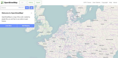
This is an online map of the world, which has been created by random users for free. You can become a contributor if you have low-tech field maps, aerial imagery, or a GPS device that enables you to provide accurate and up-to-date data. OpenStreetMap is very accurate and it’s constantly being updated by its users.
GeoCommons
This online tool enables you to create and share interactive maps. It won’t be a problem for you to get used to GeoCommons even if you have no previous experience in mapping. You will view a great base of data once you provide the needed information. You’ll be able to animate the map in a matter of seconds.
This is a great tool for educators who want to add oomph to the maps they present in class. It enables you to create a dynamic, highly-interactive map and infuse statistics to get the most engaging and informative visualization. InstantAtlas is not free, but you can use a trial version!
TargetMap
With this tool, you can present different types of data on a map of any location in the world. TargetMap enables you to locate and see your Excel data on map, so you don’t need any previous experience in mapping. The only condition is high quality. The users are supposed to publish great maps and share their knowledge about different places of the world.
Tour Builder
You want to share your travelling experiences? Tour Builder It enables you to choose locations and enrich them with video, text, and images. Then, you can share your creation for the whole world to see. You need to have a Google Account and install the Google Earth Browser Plug-in. Then, the tool will provide you with clear directions on how to create the map.
TripGeo
Were you attracted by the title of this post because you needed the best directions map? TripGeo enables you to create a Google Map with animated street view and route directions. The street view is visible from any point along the route, so you’ll have no chance of getting lost. The animated options enable you to set the speed of your journey.
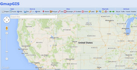
This is a slightly complicated map creation tool when compared to the previous suggestions on this list. However, it offers more functions and options, so it’s the right choice for more complex projects. You can add markers and labels, and you can draw shapes and lines. In addition, you’ll also be able to measure the distance between two points without the need to log into a Google account.
Exhibit
If you want to enrich your site with an interactive map, but you don’t want to bother with programming, then you should definitely try Exhibit. You can use the tool to incorporate maps and tiles into html documents by specifying the data columns that specify the attributes, dates, or coordinates for visualization. If you know how to use Excel, Exhibit won’t be a problem.
Heatmap Tool
There is a great choice of heatmap tools across the web, but this is the one that deserves a spot in this top list. The reason for that is simplicity and accuracy. You can create a beautiful representation of your data with complete control over the opacity, scaling, and radius of the map. The free version of Heatmap Tool enables you to craft a map with 100 data points.
MapFab
This fabulous map editing software enables you to create and share Google Maps within minutes. You don’t have to create an account! Just land at the website, enter your location, and start working on your creation. You can draw circles, lines, and polygons to make your maps more accurate and informative.
ZeeMaps
You still haven’t found the perfect tool for creating interactive maps? Try ZeeMaps – free software that enables you to create and publish this type of projects. A sign-up is not required, so you can start customizing your map without losing time. You can transform the finished project into JPEG and PDF images. That’s great if you want to include the map into a presentation.
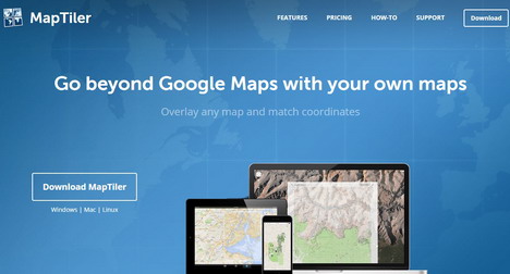
With this tool, you can overlay any map and match coordinates to come up with the perfect map for your needs. MapTiler is very rich with features, so it will take some time for you to explore all options. Nevertheless, you can still create the final product with just few clicks. The paid versions of this tool are used by Google, Apple, NASA, and other great organizations. You can use the free version, which is perfectly fine for simpler projects.
Kartograph
If you don’t like relying on Google Maps or any other service when you want to build interactive map applications, this is the right tool for you. The software combines two types of libraries: the first one generates compact SVG maps, and the second one enables you to create an interactive product based on the map you choose from the first library.
MapAList
This is the easiest way to create a Google Map that holds important address lists: you select information from your Google Spreadsheets and leave the rest to MapAList. The address list and maps will be automatically updated on a daily basis. You can make the map private, but you can also publish it if that’s what you want.
Travellerspoint
When you plan a trip, it’s important to have a clear map of the destinations you want to visit. Travellerspoint enables you to create such maps. You can also use the website to book hotels and other types of accommodation. You can also access an awesome travel guide for the most attractive tourist destinations.
Click2Map
With this free tool, you can create a customized map with built-in markers that make it more interactive and attractive. When a visitor clicks on a market, the map will launch a pop-up window with the information you insert. You can infuse photos, videos, text, or embedded HTML content in these markers.
Modest Maps
This is a free library for developers and designers who want to make their projects more informative with maps. The lightweight package includes core features that help you create a plain, but clear map in minutes. You can customize the visitors’ experience by adding your own interaction code!
ScribbleMaps
Let’s conclude this list with an amazing tool that enables you to draw and share maps. ScribbleMaps enables you to draw a pap, place markers and test, add custom images, calculate distance, draw shames, and do anything else you can think of. You can even try the Pro version for free!
Tags: google maps, map, technology, web app


