

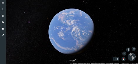
15 Amazing Things You Can Do with Google Earth
Google Earth helps you explore the world like never before. You can fly through cities, learn about landscapes and discover about the earth using this amazing tool.
1. Have a Look from Mount Everest

The ground-level view is one of the serenest things about Google Earth. In Urban areasit works like Google Map’s Street View which provides you a photographic view with high-resolution but it can also be used in distant areas like the top of Mount Everest. For this situation, the normal satellite view images are used but still, they are quite interesting.
2. Study about Distance
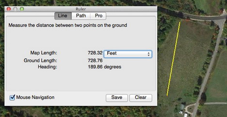
In Google Earth you can easily measure the length of the path and the distance between two points through a handy ruler tool. For using it, select Tools > Ruler. The Ruler Window will be appeared and you will select the between the Path (it gives the total distance by tracing the path) and Line (it measures the distance between two points).Your kids can also use this tool for different experiments such as to measure the units of length, to find out the distance between school and home, to measure the area of your home and study the perimeters.
3. Learn How to Fly a Plane
Through Google Earth, you can easily learn the basic flying concepts such as flaps, rudders, and ailerons. For this purpose, abuilt-in flight simulator is the tool that is easily used.

For using the simulator, select Tools > Enter Flight Simulator. You will be asked to select one option from two planes – where SR22 is easy to fly but it is more exciting to fly F-16. You can also select your current platform for starting the flight or can choose the airport runway. During fly arrows, keys will be used to control the plane’s elevators and ailerons.
4. Jump Back into the Past
In Google Map, you can step back and forward in time and sight historical images through its fantastic feature “time slider”. You can learn the history regarding the evolution of buildings and cities. At the bottom of the screen, there is a clock icon in which you click the year and step back into the past and see that what was happened in that year.
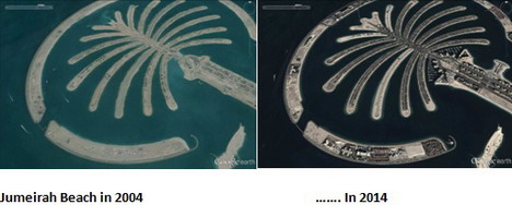
Dubai is one of those cities in the world that has developed very fast, and through Google Earth, you can examine that how this development took place. For example, by zooming into Palm Jumeirah you can see that their evolution over time. Time slider will also help you to view how your own house and surrounding have improved with the passage of time.
5. Study the Constellations
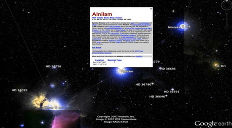
Through Google Earth, you can look down at the ground as well as look up at the sky. The sky view is the best way to study the constellations, and the system related to the making of stars. Select View > Explore > sky to see that how the sky looks from your current position.
6. Discover the Planets
Through Google Earth, you can view the planets in the night. In the Sky mode, select the Our Solar System layer to view the planets. In this portal, you see the symbol of each planet that appears in the sky. By zooming you will see the name of every planet. By double-clicking the planet’s name you can view the imagery layer.
7. View the World in Day and Night

Google Earth can be used to view the change of transformation of day into night and vice-versa. As everything is viewed through the middle of the day because it is the default setting of the Google Earth. It will help you to see the movement of stars, movement of thesun through the sky and the transformation of light and shadows on the earth.
8. Explore the Climate Change
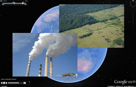
For examining the climate change, Google Earth is the best platform. It is the best place for you and your kids to take a tour to investigate the climate change and their effects on the globe in more detail. It can be viewed through a series of 3D tours that is described by Al Gore. For exploring thecertain area in more detail, you can pause the tour at any time.
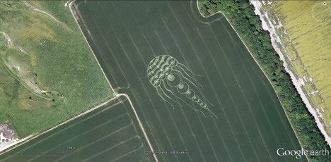
9. Investigate the Shapes in the Nazca Lines
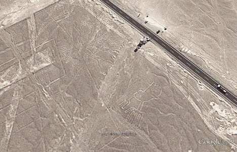
Almost 1500 years ago, in Peru, there were created mysterious Nazca Lines. If you look closely through Google Earth’s imagery, you will reveal these lines in detail.
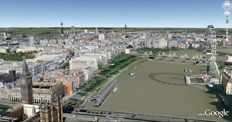
10. See Famous Landmarks and Buildings
Now the Google Earth is the best place which is chock full of 3D models and helps you to see the landmarks and buildings with afull explanation. For viewing the landmarks in 3D model view you will select the 3D Buildings layer. The London Eye, the TajMahal, andthe BurjKhalifa are some of the buildings that can be viewed through Google Earth’s 3D building layer.
11. Visit Brazilian Rainforest

3D trees are one of the main features of Google Earth that explores the forests easily. In Brazil, near the city of cacoal, there is a rainforest which can be explored through Google Earth.
12. View 3D Maps
In the previous versions of Google Earth some of the buildings were viewed in 3D, but now in the newest version, you can see the whole world in 3D. On the lower right-hand corner of the screen, there will be a 2D/3D clickable button which will give you easy access to reach your destination.
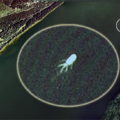
13. Drill a Hole

Google Earth can also be used to drill a hole in order to explore that how much area of the world is occupied with water.
14. Track Cruise Ships
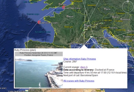
In Google Earth, you can track the current location of different cruise ships at any time. These ships are belonging to major liners such as Royal and Cunard Caribbean. By clicking the ship logos, you can get the information regarding their track and journey. When your relatives or friends will travel, it will be the best way to track their journey. EveryTrail and seascanner.com are the best websites that make the use of Google Earth more inspiring.
15. Search Your Neighborhood
You can also search your local area through Google Earth. From search bar, you can easily explore your home and after zoom out you will see how your neighbor looks like from the sky. You can also spot your friends and relatives from their roofs.
(Note: This article was updated on August 28, 2017)

You May Also Like:
 20 Most Amazing & Weird Things on Google Earth You Must See
 11 Best Google Maps Tips and Tricks You Should Learn
 Google Body Browser – Explore Human Body and Anatomy in 3D
 20 Google Maps Tools to Plan Your Trip
 10 Tips to Customize Maps with Google Map Builder
 How to Download Google Earth Maps for Offline Use
 How to Access Blocked Websites Using Google Public DNS
 15 Google Calendar Features You Should Use
Tags: 3d, google, google earth, image, photography


Thanks for sharing this article. I didn’t know this much about Google Earth. In my day today life I use Google Map only, I never planned or thought to search for Google Earth.